
Future-Ready Geodesy: Survey-Grade Hardware & Computing Power
Deploying 1,408-channel RTK GNSS receivers, DJI Enterprise multispectral UAV fleets, hydrographic echo sounders, and 14th Gen Intel Core i9 / Core Ultra 7 DDR5 workstation clusters backed by 40TB NAS central storage.
Survey-Grade Field Equipment & Aerial Fleets
Geospatial Works operates a fully owned, certified inventory of multi-constellation RTK GNSS receivers, commercial UAV drone platforms, Japanese optical levels, and digital hydrographic echo sounders.
CHCNAV i83 RTK GNSS Receiver Fleet (8 Units)
1,408 channels multi-constellation satellite tracking with static GNSS and GSM-based RTK operation up to 30 km range. Manufacturer: CHCNAV, China.
- Full tracking of GPS, GLONASS, Galileo, BeiDou, and QZSS constellations
- Centimetre-level accuracy for topographic mapping and boundary demarcation
- Static GNSS observation mode for primary geodetic control point establishment
- GSM network RTK pairing for seamless long-range corridor surveys up to 30 km
DJI Enterprise UAV Drone Fleet (7 Batteries per Platform)
DJI Mavic 3 Enterprise, DJI Mavic 3 Multispectral, and DJI Matrice 4 Enterprise with 7 high-capacity flight batteries per aircraft for continuous field operations.
- Mechanical shutter RGB sensors delivering ground sample distance < 3cm/px
- Multispectral sensor array for agricultural NDVI and vegetation health estimation
- Centimeter RTK positioning module paired directly with ground base stations
- Large-area and inaccessible site surveying across delta floodplains and corridors
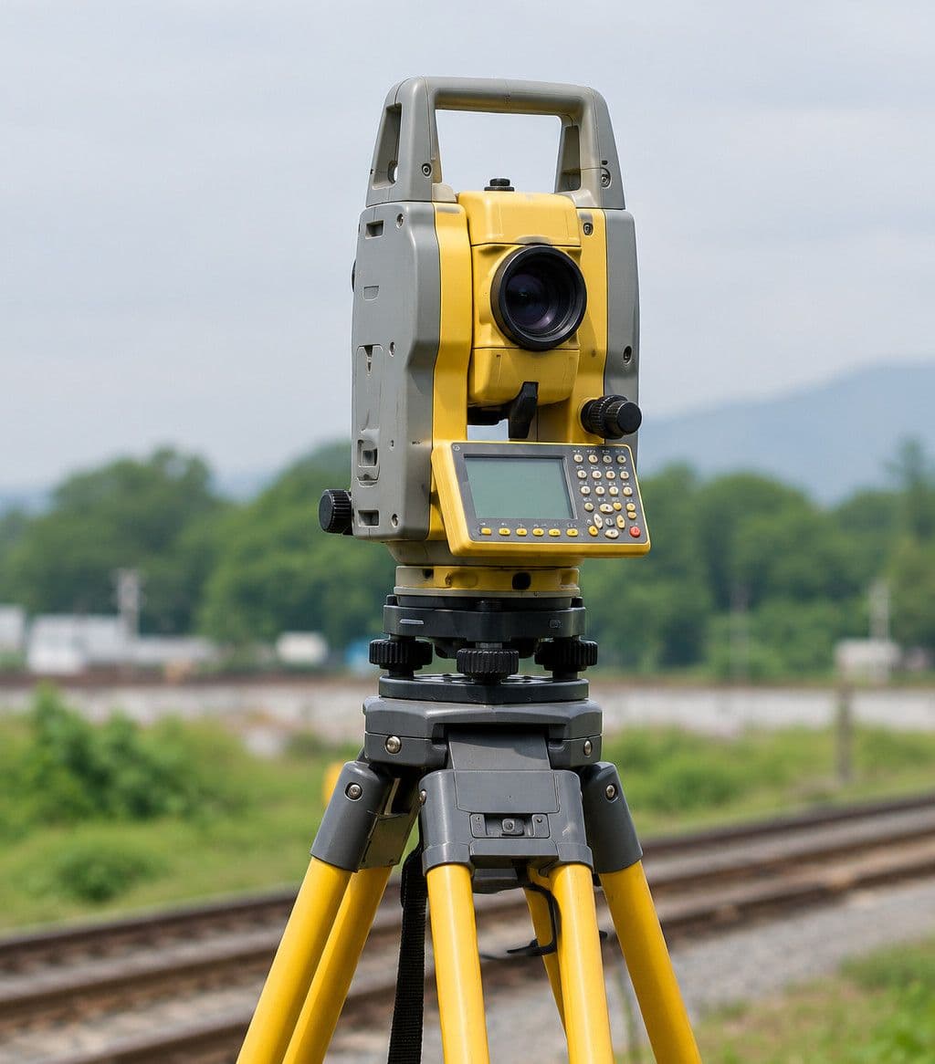
Precision Total Stations (Topcon, Sokkia, CHCNAV, Kolida)
Multi-brand total stations delivering 1-second to 2-second angular accuracy and precision reflectorless distance measurements.
- Angle and distance measurements for precise construction layout and setting out
- Cadastral boundary surveys and land parcel demarcation for legal registration
- Monitoring structural alignment, bridge piers, abutments, and high-rise verticality
- Integration with digital field books for automated CAD coordinate exports
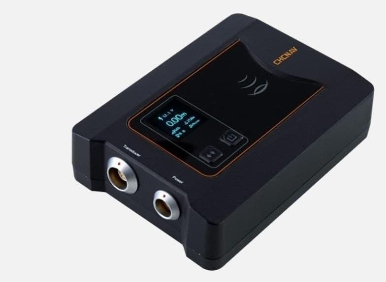
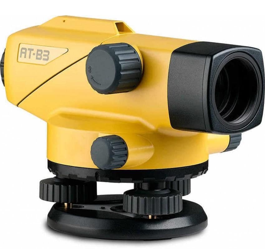
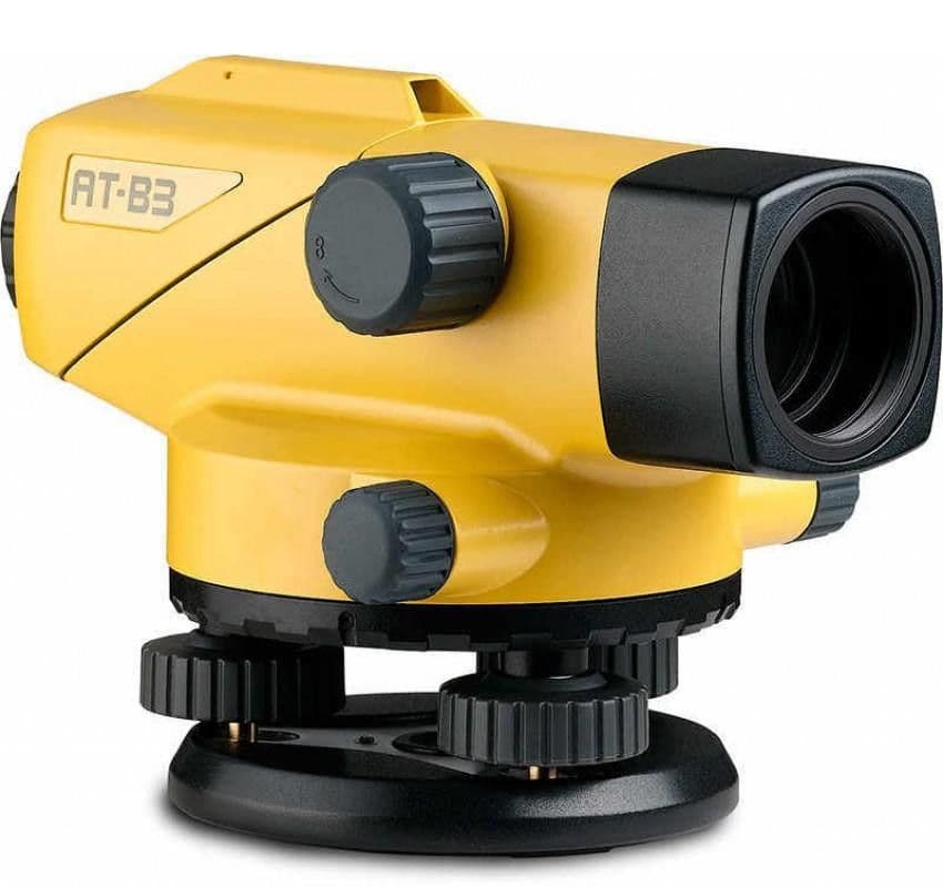
Precision Optical Levels & Hydrographic Echo Sounder
Sokkia B 20A (Japan), Topcon AT B 3 (Japan), and CHCNAV D270 Digital Echo Sounder (China) with GNSS positioning integration.
- Closed-loop digital leveling ensuring vertical closure tolerances tighter than < 5mm √K
- Transfer and establishment of Survey of Bangladesh (SOB) MSL and PWD bench marks
- Echo Sounder D270 for georeferenced underwater riverbed and canal profiling
- Bathymetric cross-sections for bridges, water-level gauges, and irrigation canals
Physical Field Equipment Registry
Official instrument register as documented in our corporate profile submitted for statutory and public works tenders in Bangladesh.
| Name of Equipment | Quantity | Manufacturer & Origin | Primary Operational Scope |
|---|---|---|---|
| CHCNAV i83 RTK GNSS Receiver | 8 Units | CHCNAV, China | Static & RTK Positioning, Control Networks |
| DJI Mavic 3 Enterprise (7 Batteries) | 1 Fleet Unit | DJI | High-Resolution Aerial Photogrammetry (< 3cm GSD) |
| DJI Mavic 3 Multispectral (7 Batteries) | 1 Fleet Unit | DJI | NDVI Vegetation Health & Agricultural Remote Sensing |
| DJI Matrice 4 Enterprise (7 Batteries) | 1 Fleet Unit | DJI | Heavy-Duty Enterprise Corridor Mapping |
| Echo Sounder D270 | 1 Unit | CHCNAV, China | Hydrographic & Bathymetric Sounding, Riverbeds |
| Level Machine Sokkia B 20A | 1 Unit | Sokkia, Japan | Precise Vertical Levelling, Benchmark Transfer |
| Level Machine Topcon AT B 3 | 1 Unit | Topcon, Japan | Site Levelling, Road & Drainage Slope Control |
| Total Stations (Topcon, Sokkia, CHCNAV, Kolida) | Multiple | Japan & China | Angle & Distance Measurement, Setting Out, Boundary |
High-Performance Photogrammetry & CAD Workstations
Geospatial Works operates dedicated high-performance desktop workstations equipped with Intel Core i7, Core i9, and Core Ultra 7 processors, high-speed DDR5 memory, and NVIDIA RTX graphics, backed by a 40TB centralized NAS storage cluster.
Intel Core i9, 14th Gen K-Series
64 GB DDR5 High-Speed MemoryHigh-density UAV photogrammetric point cloud reconstruction, bundle adjustment & orthomosaic generation
Intel Core i9, 14th Gen K-Series
64 GB DDR5 High-Speed Memory3D mesh modeling, digital surface model (DSM/DTM) extraction, and volumetric cut-and-fill analysis
Intel Core Ultra 7 K-Series
64 GB DDR5 High-Speed MemoryDeep learning spatial segmentation, multi-spectral NDVI classification, and large-scale GIS spatial databases
Intel Core i7, 14th Gen K-Series
32 GB DDR5 High-Speed MemoryAutoCAD Civil 3D alignment drafting, structural detailing, BOQ preparation, and SOB coordinate conversion
Enterprise Scalability for Massive Spatial Datasets
Our 40TB local NAS support houses raw high-resolution UAV point clouds, multi-temporal orthomosaics, satellite imagery tiles, and geodatabases with local RAID redundancy and complete data sovereignty.
Specialized Engineering & Geospatial Software Suite
Geospatial Works is equipped with a range of specialized software solutions to support field data processing, technical drawings, digital terrain models, hydrographic surveys, and 3D visualization.
Agisoft Metashape Pro
Dense point clouds, georeferenced orthomosaics, and 3D textured mesh generation from drone flights.
DJI Terra
Real-time 2D/3D mapping, LiDAR point cloud reconstruction, and mission route optimization.
AutoCAD Civil 3D
Corridor modeling, road geometry, cross-sections, pipe networks, and earthwork cut/fill computation.
ArcGIS Pro & QGIS 3.x LTR
Enterprise spatial geodatabase design, vectorization, thematic mapping, and spatial decision support.
MIDAS-Civil & ETABS
Finite element structural analysis for high-rise towers, multi-span RCC girder bridges, and viaducts.
STAAD-Pro CONNECT & SAFE
Foundation mat/raft engineering, deep pile capacity, retained earth palisading, and culvert designs.
Keep in touch
From corridor surveying to UAV photogrammetry and spatial databases, reach our engineering team for technical consultation and deployment.
Geospatial Works Ltd.
64/1 (D1), Lake Circus, Kalabagan, Dhaka 1205